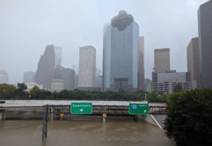
First of all, we’re safe, doing well, and the houses are clear from flooding at the moment
Over the past couple years, I’ve put together a list of favorite places to get data, maps, and information. I was finally able to put some of it to use over the weekend.
Weather Forecasting
These folks are freaking awesome. They keep it short and sweet and back it up with tons of data with no bullshit hype.
Space City Weather
- Tuesday – Yeah, this weekend is looking wet for Texas
- Wednesday – Harvey redevelops in southern Gulf, will bring major rains to Texas
- Thursday – Harvey late night: Some final Thursday thoughts
- Friday – Category four Harvey slowly approaches landfall near Rockport
Maps and Gauges
From flood maps to bayou gauges, anything that would help me understand when we were in trouble is really helpful.
Harris County Flood Education Mapping Tool
http://www.harriscountyfemt.org/
Before purchasing homes in the near downtown, we check made sure we had a low chance of flooding since we are near Buffalo Bayou. Luckily, we’re just outside the 500-year floodplain.

United States Geological Survey
https://nwis.waterdata.usgs.gov/tx/nwis/uv?site_no=08074000
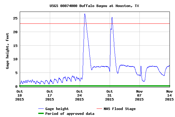
The gage site is near us, so it’s a great way to keep track with their WaterAlert tool. I set it up to notify me when the height is above 23 feet and 30 feet. It’s also an interesting way to see the historical trends in order for us to prepare for current and future flooding events.
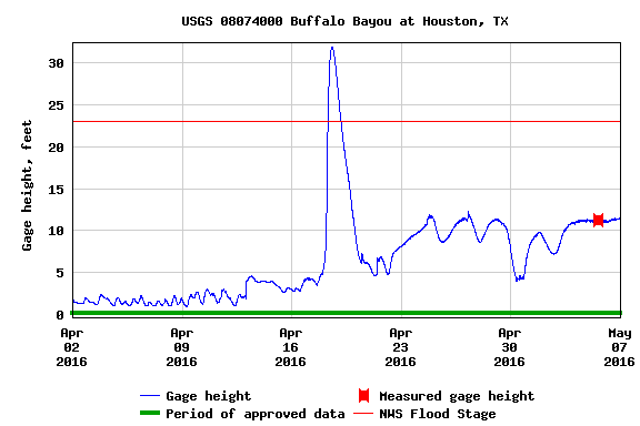
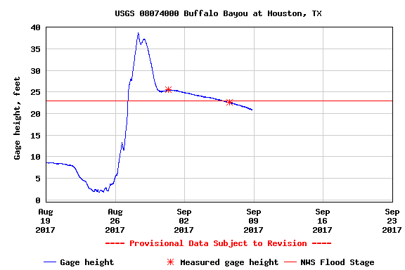
Each graph is five week’s worth of data, and noticed that when it stops raining, the bayou drains out pretty quickly. We just need Harvey to chill out and let the water recede a little bit.
September 8, 2017 Update
 | 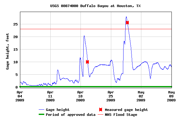 | 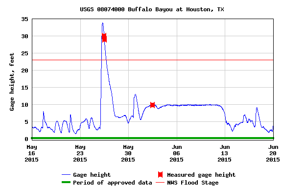 |
| Hurricane Ike September 2008 | Flooding April 2009 | Memorial Day May 2015 |
 |  |  |
| Hurricane Patricia October 2015 Â | Tax Day Flood April 2016 | October 2017 Hurricane Harvey |
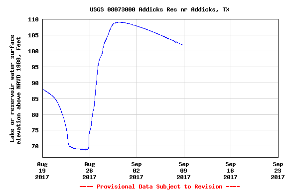
Zooming in on the Harvey gauge profile, notice how long it’s taking the water levels to go down compare to all other events. This is because the city has open up the Addicks and Barker Reservoirs, dumping a tons of water into Buffalo Bayou. You can see the water levels at both reservoirs are extremely high and now slowly draining out.
 |  | 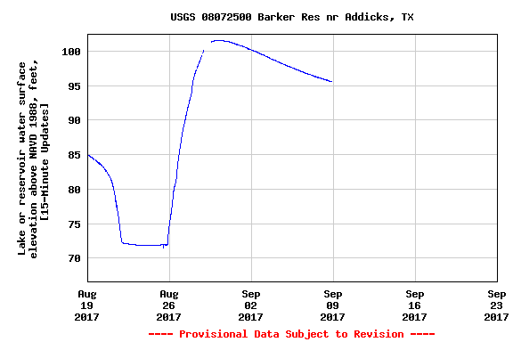 |
| Addicks and Barker Reservoirs Map  | Addicks Reservoir | Barker Reservoir |
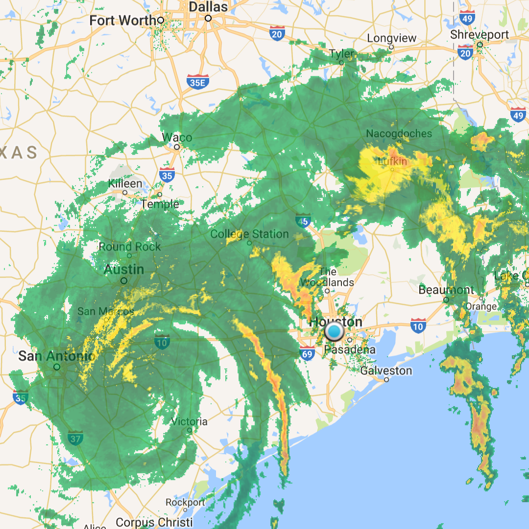
Raindar
Google Play Store: Raindar
This is map is super useful to find out where the heavy rainfall is located in the area, along with a time lapse to help predict the path.
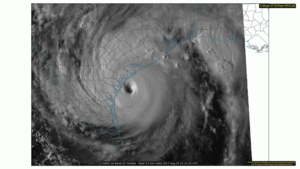
CODNEXLAB
http://weather.cod.edu/satrad/exper/?parms=meso1-02-24-0
This map is just hauntingly beautiful. Keep in mind the one linked is a live feed for visible spectrum, so if it’s night time, you won’t see anything. Just change what you want to see – water vapor, infrared, and bunch of other things I don’t know about.